Map of Kyushu
Kyushu is the large island in the southwest corner of the Japanese archipelago, and Fukuoka sits on its northern tip, facing the Genkai Sea across from Korea. This guide walks the map from prefecture to prefecture and turns geography into a routing plan.
Short answer
Kyushu is Japan's third-largest island, occupying the southwest of the archipelago, southwest of Honshu and west of Shikoku. It holds seven prefectures: Fukuoka, Saga, Nagasaki, Kumamoto, Oita, Miyazaki and Kagoshima. Fukuoka City, the region's largest, sits on Hakata Bay on the Genkai Sea, the closest major Japanese city to the Asian mainland.
Kyushu is the big island in the southwest corner of Japan, and almost every traveller arriving there lands in the same place: Fukuoka, on the island's northern shore. The geography of Kyushu is not trivia. It decides which day trips are easy, which ones need a full day, why the ramen is rich and porky here, and why typhoon season is a real planning factor from July through October. This page reads the map the way a trip planner needs it read, prefecture by prefecture, with Fukuoka as the anchor point.
Where Is Kyushu on a Map of Japan?
Kyushu is the third-largest of Japan's four main islands, sitting in the southwest of the archipelago, directly south of the western end of Honshu and west of Shikoku. Its northern coast faces the Genkai Sea and the Korea Strait, which makes Fukuoka, on that coast, the closest major Japanese city to the Asian mainland. The island holds seven prefectures of volcanic peaks, hot spring towns and rice-growing plains.
Open any map of Japan and your eye probably goes to the bow of Honshu first, the big island carrying Tokyo, Osaka and Kyoto. Kyushu is the large landmass hanging off Honshu's western end, separated from it by a narrow strait at Shimonoseki that is crossed by both bridge and tunnel. The island is roughly the size of a small European country, yet it fits seven distinct prefectures inside it, each with its own food culture and its own landscape.
The northern shore is where most visitors spend their time, and for good reason. Fukuoka City sits on Hakata Bay, which opens onto the Genkai Sea. This is worth stating plainly because a remarkable number of guides get it wrong: Fukuoka is not on the Pacific Ocean and it is not tropical. The city faces north, toward Korea and the Asian continent, and that northern exposure shapes everything from its winters to its food.
The island's position also explains its history. For centuries, the port of Hakata was one of Japan's front doors, the place where goods, ideas and people arrived from China and Korea. That legacy still runs through the city, from the kelp broth in its udon to the shrine festivals that fill its summer calendar. If you want the deeper story of what this region became, our guide to Kyushu as a region picks up where this map leaves off.
The Seven Prefectures of Kyushu, Mapped
Kyushu contains seven prefectures: Fukuoka and Saga across the north, Nagasaki filling the western arm, Kumamoto at the island's centre, Oita on the northeast coast, Miyazaki along the eastern shore, and Kagoshima at the southern tip. Fukuoka Prefecture holds by far the largest city and the main transport hub, which is why nearly every Kyushu itinerary starts there. Each prefecture has one clear headline attraction, and the map shows how they chain together.
Learning the prefectures is the single most useful thing you can do before planning a trip, because the rail lines and the day trips follow the geography. Here is the map in table form, north to south.
| Prefecture | Position on the island | Headline reason to visit |
|---|---|---|
| Fukuoka | Far north, on Hakata Bay and the Genkai Sea | Hakata ramen, yatai stalls, Dazaifu Tenmangu, the November sumo tournament |
| Saga | Northwest, between Fukuoka and Nagasaki | Arita and Imari porcelain towns, Yoshinogari historical park |
| Nagasaki | Western arm reaching toward the East China Sea | The harbour city, its peace memorials, Dutch and Chinese trading history |
| Kumamoto | Centre of the island | Kumamoto Castle, Mount Aso's enormous volcanic caldera |
| Oita | Northeast coast | Beppu's hot springs and the "hells", Yufuin's onsen village |
| Miyazaki | Eastern shore facing the Pacific | Takachiho Gorge and its shrines, coastal scenery |
| Kagoshima | Southern tip | Sakurajima volcano, Chiran, ferry links to the Ryukyu islands |
Two details on this map surprise people. The first is that Nagasaki Prefecture is not just the city: it is a long mountainous arm with hundreds of islands trailing off it, which is why a Nagasaki day trip from Fukuoka is a full twelve-hour commitment. The second is that Oita and Miyazaki face east and south, onto the Pacific, while Fukuoka faces north. The island genuinely spans two seas, and the weather can differ noticeably between its shores.
The prefectures also chain together neatly by rail. Fukuoka to Kumamoto to Kagoshima runs down the island's western side on the shinkansen line. Fukuoka to Oita runs along the northeast coast. The eastern and southern reaches, Miyazaki and the more rural parts of Kagoshima, are where a rail pass earns its keep or a rental car starts to make sense. For the full breakdown of what each prefecture contributes, see what Kyushu is best known for.
If you are planning to move between several of these rather than day-tripping from one base, the practical question is whether to buy a regional rail pass or pay as you go. Our JR Kyushu rail pass guide works through that arithmetic, and the nationwide Japan Rail Pass from Fukuoka comparison covers the island-hopping case. And for travellers who prefer someone else to handle the logistics, these three tours cover the map in very different ways.
Fukuoka's Place on the Kyushu Map
Fukuoka City sits on the northern edge of Kyushu, on Hakata Bay, an inlet of the Genkai Sea. Within the city, Hakata is the ward and the main station name, not a separate destination, and the city's key districts, Hakata, Tenjin and Nakasu, sit within a few kilometres of each other on the subway. The bay itself holds Nokonoshima, Shikanoshima and the Uminonakamichi sandbar, all reachable as short hops. This compactness is the city's great travel advantage.
The relationship between Hakata and Fukuoka confuses visitors more than any other piece of Japanese geography, so it deserves a clean sentence: Hakata is a ward of Fukuoka City and the name of its principal station. They are not two cities and not two districts you travel between. There is no such thing as a JR Fukuoka Station; the shinkansen and most trains arrive at Hakata. Competing guides routinely write "Fukuoka and Hakata" as though they were neighbours, and that error cascades into bad routing advice.
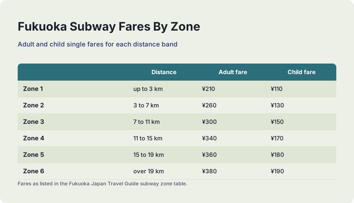
The city's layout is genuinely easy once the naming is sorted. The subway's Airport Line runs from Meinohama in the west through Ohori Park, Tenjin, Hakata and out to Fukuoka Airport, with fares from ¥210 for the shortest zone up to ¥380 for the longest. A one-day pass covering all three lines costs ¥640 for an adult, sold at station machines and the tourist information counters at Tenjin, Hakata Station and the airport. The official fare table is published by the Fukuoka City Subway.
| Subway zone | Distance | Adult fare | Child fare |
|---|---|---|---|
| Zone 1 | up to 3 km | ¥210 | ¥110 |
| Zone 2 | 3 to 7 km | ¥260 | ¥130 |
| Zone 3 | 7 to 11 km | ¥300 | ¥150 |
| Zone 4 | 11 to 15 km | ¥340 | ¥170 |
| Zone 5 | 15 to 19 km | ¥360 | ¥180 |
| Zone 6 | over 19 km | ¥380 | ¥190 |
The airport deserves its own paragraph because it is the reason Fukuoka works as a base. Fukuoka Airport (FUK) sits on the subway's Kuko line, and the ride into Hakata costs ¥260, placing it in the second fare zone. The airport is unusually close to the centre, which is true and officially derivable from the fare band; the widely repeated journey time in minutes is not something any official page confirms, so this guide does not print one. A free inter-terminal shuttle bus connects the international and domestic terminals, which the airport's access page states takes ten minutes.
Inside Hakata Bay, the map gets interesting. Nokonoshima, a small island with a famous flower park, sits just off the city's western shore, and Shikanoshima guards the bay's mouth. The Uminonakamichi sandbar curls along the bay's northern edge, home to a large seaside park and the Marine World aquarium. These are short ferry or rail hops, not expeditions, which is unusual for a city of this size. The Nokonoshima Island Park guide covers the island in detail.
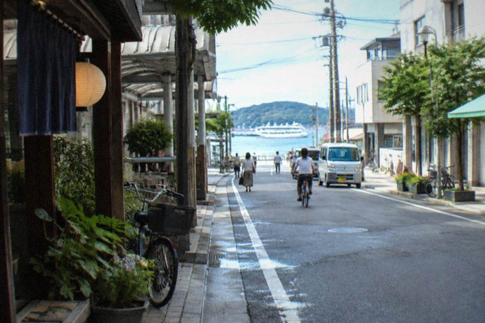
For orientation on foot, a half-day city walking tour is an efficient first move, and the roster's city essentials option covers the historic core.
If you are weighing which district to sleep in, the decision follows the map: Hakata for the station and airport line, Tenjin for shopping and dining, Nakasu for nightlife. Our where to stay in Fukuoka guide works through the trade-offs, and the Hakata-versus-Tenjin question gets its own treatment there.
How Far Is Kyushu from Tokyo and Osaka?
Kyushu's northern tip is separated from the Tokyo region by the full length of Honshu, which is why most long-distance travellers fly into Fukuoka Airport or take the shinkansen down the Sanyo line through Osaka and Hiroshima. From Tokyo, the ride to Hakata Station is a full day on trains. From Osaka or Kyoto, it is a comfortable half-day. Flying is competitive on time from Tokyo and usually the practical choice.
The honest framing is that Kyushu is far from Japan's big eastern cities but extremely well connected to them. The Sanyo Shinkansen threads down Honshu's south coast and terminates at Hakata, so the island is the end of the line rather than an awkward branch. Our Tokyo to Fukuoka guide lays out the train-versus-plane arithmetic, including when a domestic flight wins.
What the map adds is the sense of scale. Travelling from Tokyo to Fukuoka is a journey across most of Honshu before you even reach Kyushu. Once you are on the island, though, everything compresses: the shinkansen hops from Hakata down to Kumamoto and Kagoshima in the island's west, and the highway network covers the rest. Many visitors fly in, spend the whole trip within a short radius of Fukuoka, and leave feeling they have seen Kyushu, which is a bit like seeing one prefecture of it.
The international picture matters too. Fukuoka's position on the Genkai Sea makes it the natural Japanese gateway from Korea, China and Taiwan, with short flights and a high-speed ferry link to Busan. The city's visitor numbers reflect that: this is the part of Japan where East Asian short-break travel concentrates, which shows up in everything from the airport's international terminal to the multilingual menus along the yatai rows.
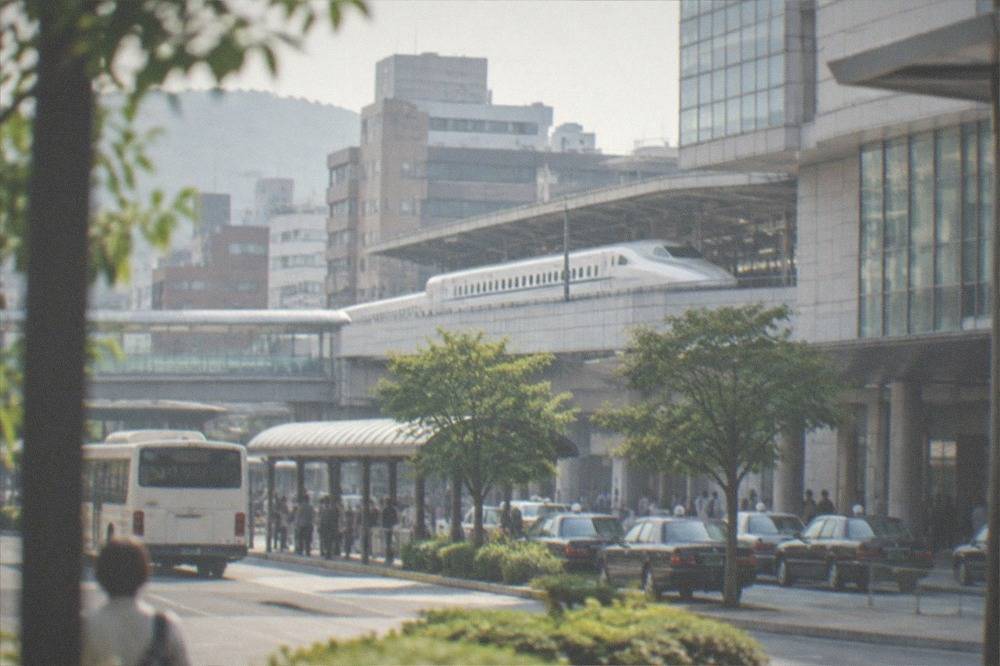
Getting Around the Island
Within Kyushu, the practical choices are the shinkansen down the western corridor, conventional JR lines across the rest, the private Nishitetsu network around Fukuoka and Dazaifu, buses for the mountain interiors, and rental cars for the coasts of Itoshima and the peninsula roads of Nagasaki. A subway day pass at ¥640 and the Nishitetsu bus day pass at ¥1,200 cover the city itself. The Tourist City Pass, at ¥2,500 for the city version, is restricted to overseas visitors on short-stay visas, with a passport checked at purchase.
City transport first, because every regional day trip starts with it. The subway's three lines cover Hakata, Tenjin, the airport and the western districts. Nishitetsu runs the trains that reach Dazaifu, one of the region's most visited sights, and a dense city bus network fills the gaps. The verified pass prices are worth knowing before you buy anything. The full index of guides sits on Fukuoka Japan Travel Guide.
| Pass | Adult price | What it covers |
|---|---|---|
| Subway 1-day pass | ¥640 | All three subway lines, first to last train |
| Nishitetsu bus 1-day free pass | ¥1,200 | City buses across Fukuoka, plus listed attraction discounts |
| Fukuoka Tourist City Pass | ¥2,500 | Subway, Nishitetsu trains and buses, some JR lines and ferries, one day, overseas short-stay visitors only |
| City Pass with Dazaifu | ¥2,800 | The above plus Nishitetsu coverage out to Dazaifu, excluding the Tabito liner bus |
The Tourist City Pass deserves its own note because most competing guides still quote prices from years ago. The verified figures are ¥2,500 for the city version and ¥2,800 with Dazaifu, and the pass is checked against your passport at the counter because it is restricted to overseas tourists on short-stay visas. Getting this right, with the restriction stated, is one of the small things that separates a researched guide from a copied one.
Beyond the city, the map determines the mode. The shinkansen serves the western side of the island: Kokura, Hakata, Kurume, Kumamoto, Kagoshima. Note one wrinkle that catches rail pass holders: the Hakata to Kokura shinkansen segment runs on JR West's Sanyo line, so a JR Kyushu pass does not cover it. The northeast coast to Oita and Beppu is conventional rail, as is the eastern run toward Miyazaki. The mountainous interior, the Itoshima peninsula and the Nagasaki arm are where buses and cars take over.
Day Trips and Touring Routes the Map Makes Easy
From Fukuoka, the easy day trips split into two rings. The inner ring, Dazaifu, Yanagawa, Nokonoshima, Shikanoshima, Itoshima and Uminonakamichi, takes half a day to a full day. The outer ring, Beppu, Yufuin, Mount Aso, Takachiho, Kumamoto and Nagasaki, is full-day country, with Nagasaki the longest at around twelve hours. Guided tours compress the outer ring efficiently because the distances eat driving time that a first-time visitor underestimates.
The inner ring is what makes Fukuoka unusual among Japanese cities. Dazaifu Tenmangu, the shrine of learning, is a Nishitetsu ride away and charges no entrance fee, opening from 6:00 or 6:30 depending on season and closing between 18:30 and 19:30 by month. Yanagawa's canal boats, the Itoshima coast and the islands of Hakata Bay all sit within a short radius. Our Kyushu itinerary built from Fukuoka covers multi-day routing across the whole set.
The outer ring rewards planning. Beppu's hot spring "hells" and Yufuin's onsen village sit on the northeast coast. Mount Aso's caldera and Kusasenri grasslands lie in Kumamoto's east. Takachiho Gorge, technically in Miyazaki, is a deep-day trip through the island's mountainous middle. Nagasaki is the outlier: far to the west, a full private day tour there runs twelve to thirteen hours door to door. Do not let any guide talk you into a half-day Nagasaki.
| Destination | Ring | Realistic time budget | Getting there |
|---|---|---|---|
| Dazaifu | Inner | Half day | Nishitetsu train via Futsukaichi |
| Yanagawa | Inner | Half to full day | Nishitetsu train, canal boats on arrival |
| Nokonoshima | Inner | Half day | Short ferry from Meinohama |
| Itoshima coast | Inner | Half to full day | Rail plus bus, or car |
| Beppu and Yufuin | Outer | Full day, 10 hours | Conventional rail or guided tour |
| Mount Aso | Outer | Full day, 10 hours | Rail plus bus, or guided tour |
| Takachiho Gorge | Outer | Full day, 9 to 11 hours | Guided tour is the practical route |
| Nagasaki | Outer | Full day, 12 to 13 hours | Rail, or private tour |
Guided tours earn their price on the outer ring because they convert two or three transfers into one seat. The Itoshima coast is a good example: beautiful, but scattered, with the best spots spread along a peninsula that rewards a driver who knows the road. The hidden gems day tour from the roster covers exactly that gap.
The bay islands are the gentler option, and the best of them pairs Nokonoshima's park with a wagyu barbecue on the island, a half-day that combines the flower fields and the sea air in one booking.
Weather Across the Island, and When the Map Matters
Kyushu's climate runs from the subtropical south to four distinct seasons in the north, with Fukuoka's official averages showing a mild winter, a hot humid summer and a July that is wetter than June, 299.1 mm against 249.6 mm. Typhoon season runs roughly July through October and is a genuine planning factor, especially for coastal and island days. Spring and autumn are the sweet spots, with cherry blossoms in late March and leaf colour from mid-November.
The July rainfall figure surprises people every year, because June is the tsuyu rainy season and every generic guide names it the wet month. The Japan Meteorological Agency's 1991 to 2020 normals for the Fukuoka station say otherwise: July averages 299.1 mm of rain to June's 249.6 mm, and July is also Yamakasa month, when the city stages its biggest festival. August, for contrast, is hotter than July, drier than both, and the second sunniest month of the year after May. This is the kind of detail that changes a packing list.
| Month | Mean temperature | Daily high | Rainfall |
|---|---|---|---|
| January | 6.9 °C | 10.2 °C | 74.4 mm |
| April | 15.4 °C | 19.9 °C | 118.2 mm |
| July | 27.4 °C | 31.2 °C | 299.1 mm |
| October | 19.6 °C | 23.7 °C | 94.5 mm |
Typhoon season is the one piece of the map that can genuinely rewrite a plan. Systems track toward Kyushu from the southwest between roughly July and October, and when one approaches, ferries stop, island day trips cancel and coastal viewpoints close. The honest framing is not a warning but a contingency: keep the island and boat days flexible, keep the museum and indoor days as fallbacks, and check the forecast rather than the calendar. Our typhoon season in Fukuoka page explains what actually happens and what does not.
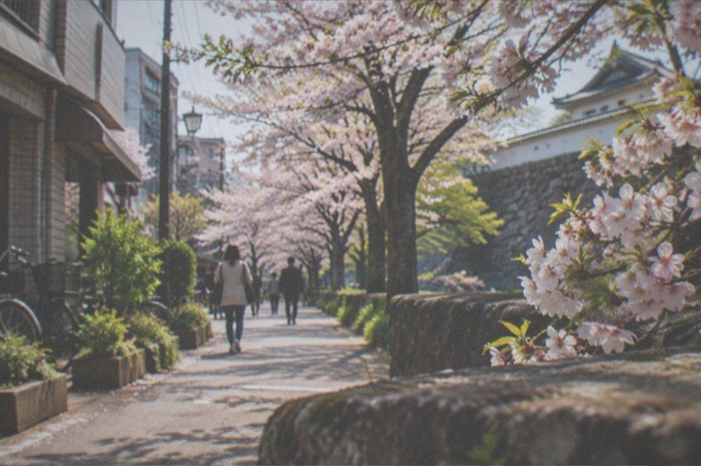
The seasonal highlights are worth building a trip around. Cherry blossoms open in Fukuoka in late March, with Maizuru Park's castle ruins among the best viewing spots. Autumn colour peaks from mid to late November into early December in the city parks. Summer is festival season, with Hakata Gion Yamakasa running July 1 to 15 and the Dontaku crowds filling Meiji-dori in early May. Each has its own rhythm, and the timing question is really a question about which of these you want.
Planning Your Route Around the Island
The standard first-timers' route is Fukuoka as a base for three or four nights, with inner-ring day trips, then a move down the western shinkansen corridor through Kumamoto to Kagoshima, or east along the coast to Beppu and Yufuin, returning by rail. Travellers with a week or more can add Takachiho and Miyazaki in the east. The map rewards a hub-and-spoke start followed by a one-way sweep, rather than a rushed circuit of all seven prefectures.
The mistake the map punishes is ambition. Kyushu looks small next to Honshu, but the mountainous interior means the eastern and southern prefectures take real time to reach, and a seven-prefecture circuit in a week leaves you seeing mostly train windows. The better plan is two bases: Fukuoka first, using its transport density and food scene, then a second base such as Kumamoto, Kagoshima or Yufuin for the sights that sit beyond day-trip range.
Food should shape the route as much as the sights, because Kyushu's map is a menu. Hakata ramen, the tonkotsu style born in this city, is covered in our Hakata ramen guide, and the yatai stalls, about 100 of them under a city ordinance that requires posted prices, get their own treatment in the Fukuoka food guide. The island-wide picture is in our Kyushu ramen comparison, where each prefecture's bowl reflects its local palate.
For onward travel beyond Kyushu, the map offers three exits: the shinkansen back up Honshu, flights from Fukuoka Airport to anywhere in the country, and the ferry to Busan for Korea. The where to go after Fukuoka page ranks the options, and the Fukuoka airport guide covers the flying logistics. Wherever you go next, the island's geography will have done half the planning for you.
If a guided day is the right fit for part of your route, these three cover the map's three most requested experiences: the bay islands, the deep interior, and the city itself on your own terms.
Common Questions About the Kyushu Map
Where Is Kyushu On A Map Of Japan?
Kyushu is the large island in Japan's southwest, directly south of the western end of Honshu and west of Shikoku. Its northern coast, where Fukuoka sits on Hakata Bay, faces the Genkai Sea and the Korea Strait. On most maps of Japan it is the lower-left landmass, the end of the shinkansen line from Tokyo and Osaka.
What are the 7 prefectures of Kyushu?
Fukuoka, Saga, Nagasaki, Kumamoto, Oita, Miyazaki and Kagoshima. Fukuoka holds the region's largest city and transport hub; the other six each hold one headline sight, from Beppu's hot springs in Oita to Sakurajima's volcano in Kagoshima.
Is Fukuoka the same place as Hakata?
Yes and no, in the way that matters. Hakata is a ward of Fukuoka City and the name of its main station. They are not two cities, and there is no JR Fukuoka Station. Trains arrive at Hakata Station, inside Fukuoka, on the island of Kyushu.
Which sea is Fukuoka on?
Fukuoka City sits on Hakata Bay, which opens onto the Genkai Sea, on Kyushu's north coast. It is not on the Pacific Ocean and it is not tropical. The bay holds Nokonoshima, Shikanoshima and the Uminonakamichi sandbar, all short hops from the centre.
Can you see all of Kyushu on day trips from Fukuoka?
The inner ring, yes: Dazaifu, Yanagawa, Itoshima and the bay islands are half to full days. The outer ring, Beppu, Yufuin, Aso, Takachiho and Kumamoto, works as full guided days. Nagasaki is the exception, a twelve-hour commitment that is better as an overnight or a dedicated full-day tour.
What is the best way to travel around Kyushu?
The shinkansen covers the western corridor from Hakata to Kumamoto and Kagoshima. Conventional JR lines reach Oita and the northeast coast. Buses and rental cars serve the mountainous interior, Itoshima and the Nagasaki peninsula. Inside Fukuoka, the subway, a ¥640 day pass, and the Nishitetsu network handle nearly everything.